After the decision on the reconstruction of the building, the design organizations begin to collect initial information: archive drawings, survey data, measurement plans, clouds of points.
- Archive data. This is the easiest way to get information about the building. Often, however, archival data may be lost or lost due to numerous reconstructions and remodeling.
- Survey data. During the renovation of buildings, survey is a prerequisite for further design. The survey provides data on the load-bearing capacity of the elements, visible and not visible structural damage.
- Measurement plans. They are obtained with simple measuring elements such as roulette, caliper and so on.
- Clouds of dots. This is the modern method of obtaining the size of a building and its elements. A point cloud is a data array of points with their coordinates, color, and reflectivity.
Once these data are available, design can proceed. However, if design were to be introduced in a three-dimensional environment, it would be better to combine all the data into a single measurement model.
For the reengineering of the complex of buildings for the «Incarnation» of the company IM Consulting were provided with measurement models, clouds of points, and classic drawings.
The objective of the re-engineering was to obtain the basis for further design and creation of a unified database of reconstruction objects.
Issues arising in the performance of work
Integrating all types of information into a single model.
During the initial data collection the customer applied two methods of information collection: field measurements and laser scanning.
The laser scanning was done only on the outside of the buildings to obtain full information about the facades of the building, as well as linking the buildings together. As a result, the scanning resulted in clouds of points of all reconstructed buildings outside (Fig.1)

Figure 1 Cloud of the facades of the building
Inside the buildings, measurements were made using a classic roulette method, resulting in measurement plans (fig. 2) and cuts (fig. 3)

Figure 2 Measurement plan

Figure 3 Measurement cut
Laser scanning is a more accurate measurement method than classical roulette measurements, and the main difficulty in this project was to link drawings and cloud points. The problem was also compounded by the long length of the building, because due to an error even one-tenth of a degree, the error in coordinates can be up to 10 centimeters.
We have had to make some concessions to address this problem. To begin with, we’ve identified the most critical areas where we can’t deviate from measurements by one millimeter. The basis was the plans, they are at least less accurate, but for the design is much more important the position of the supporting structures, than turning the outer wall half a degree. Since the facade model was already mapped to a cloud of dots (Fig.4), we continued working in a new file and attached the existing facade. However, to achieve continuity of the model it was necessary to adjust the external walls.

Figure 4 facade model of the building
Result
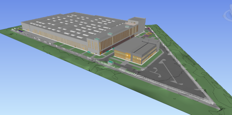
As a result, 4 models of the building were obtained, which are fully ready for further design. It is also possible to insert survey data into the model to create a single information field.

Figure 5 section of the completed building